The Greenland Hazards Project
Abstract
Navigating the New Arctic (NNA) is one of NSF's 10 Big Ideas. NNA projects address convergence scientific challenges in the rapidly changing Arctic. This Arctic research is needed to inform the economy, security and resilience of the Nation, the larger region, and the globe. NNA empowers new research partnerships from local to international scales, diversifies the next generation of Arctic researchers, enhances efforts in formal and informal education, and integrates the co-production of knowledge where appropriate. This award fulfills part of that aim by addressing interactions among the natural environment, social systems, and the built environment in the following NNA focus areas: Arctic Residents, Data and Observation, Education, and Resilient Infrastructure.
As the Arctic warms, the environment is rapidly changing; ice sheets, ice caps, and glaciers are thinning and receding; and permafrost is degrading. In some areas, such as southeastern Alaska and Greenland, these changes can trigger landslides, which in turn can generate localized tsunami-like waves when the landslides flow into fjords and other coastal waters. Since 1995, several coastal landslides have triggered tsunami-like waves, tragically resulting in the loss of lives, damage to infrastructure, and the abandonment of communities in western Greenland. This project is carefully mapping how Greenland is changing in response to ice thinning and is exploring the developing risk of landslides and other hazards. The research integrates local observations made by Greenlandic people in their communities with data collected through advanced remote sensing to learn how hazards evolve over time. The collaboration between US and Greenlandic scientists and Greenlandic residents will be critical to ensure that the research addresses community needs. This project is providing the first Greenland-wide analysis of unstable land and how hazards affect infrastructure and society, while prototyping a monitoring system that could provide warning of approaching large waves.
Researchers are examining and modeling high energy events such as rockslides and avalanches to ascertain their potential tsunami threats to communities around the country. The project team hypothesizes that the known distribution of recorded landslides is controlled by rock type, slope and aspect and then by proximity to retreating glaciers, changing permafrost, temperatures and precipitation. Satellite radar, optical imagery and topographic differencing are being used to investigate geophysical changes and how they alter hazards on regional scales. On local scales, drone surveys are examining permafrost changes and rock instabilities on seasonal to sub-daily timescales. Machine learning and modeling are being applied at all scales to identify patterns of change. In addition, a qualitative study is advancing our understanding of the communication processes through which scientific and Greenlandic communities give meaning to environmental changes and hazards through diverse ways of knowing and multiple forms of expertise. The project is building capacity for geodesy, remote sensing, and machine learning through a series of workshops in Greenland. A multilingual website is providing a source of open, intuitively understandable, and easily accessible information that municipalities can use to inform decision making and policy. The project is developing a communication-theory based virtual workshop on community engagement at annual NNA meetings that is being shared with program managers at NSF. The project data are useful to a wide range of disciplines, with work relevant to solid earth geophysics, glaciology, oceanography, natural hazards, and the field of communication.
Logistics Summary
During a period of five field seasons (2022 – 2026), up to three U.S. researchers will deploy to Greenland twice a year for two weeks each visit. Over the course of the study, researchers will conduct in-depth interviews with 60 participants recruited from scientific and local communities, as well as annual focus groups composed of representatives from science, municipalities, and local government. Interviews and other participant engagement may take place via virtual/phone contact as an alternative to in-person visits. In 2022 researchers will travel to Nuuk to meet with their Asiaq colleagues, discuss field deployment locations and begin making contacts in municipalities. In 2023 and 2024, researchers will install three Global Navigation Satellite System Interferometry and Reflectometry (GNSS-IR) tide-gauges in target villages and three additional prototype GNSS-IR gauges at remote locations (that require access via helicopter) designed to provide timely warning of large waves from storms, capsizing icebergs, or triggered by landslides. The exact locations of each GNSS-IR site will be determined in consultation with Greenlandic communities, Asiaq, and sea-level specialists at Technical University of Denmark (DTU) and the Danish Agency for Data Supply and Efficiency (SDFE). In 2025 and 2026 they will focus on workshops that will provide skills, tools, and datasets to Greenlandic residents and institutions that can be used to address threats in their communities and infrastructure from the changing natural environment, and to perform maintenance, if needed, at the GNSS-IR sites.
Battelle ARO will provide COVID-19 mitigation support (quarantine guidance, lodging, per diem, and testing for team members), Air National Guard (ANG) coordination for passengers, lodging in Kangerlussuaq, and AirGreenland coordination between Kangerlussuaq and Nuuk, and in 2023-24 only: helicopter support. EarthScope will provide cGPS systems and GNSS receivers. All other logistics will be organized and paid for by the researcher through the grant.
Resources
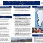
Negotiating Expertise in the Greenland Hazards Project
Jessica Rich
The Greenland Hazards Project (GHP) partners Earth scientists from the University of Colorado Boulder (CU) and Virginia Tech (VT) with community, science, and government collaborators in Greenland to address the interplay between evolving natural hazards, society and infrastructure in the changing climate of Greenland. The goal is to build capacity for geodesy, remote sensing and machine learning at Greenlandic institutions and in Greenlandic communities.
2022
Project Website
Project PI(s)
Funded Institutions
University of Colorado Boulder
Other Research Location(s)
Kangerlussuaq, Greenland
Nuuk, Greenland
Project Start Date
Jan 2022
Award Year
FY21
Award Number(s)